Windermere Best Views
13 Windermere and Bowness from Claife Heights
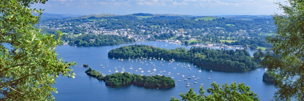
The ruined folly of Claife Viewing Station stands on the hillside just above Ferry Point on the western shore of Windermere, and is well worth a visit.
Get the view
Start Ash Landing car park near Ferry House, Windermere
Grid Reference SD 38759 95383
What3words Reference secrets.forgot.array
Walk up the path at north-east end of the car park, and turn left up to Claife Viewing Station. Go through the archway behind the building, and follow the path slanting up-hill for about ½ mile, which then enters a walled track. At junction of walled tracks turn left, then after about ¼ mile, turn right. Follow track into woodland for about ¾ mile, then after ascending Low Pate Crag, go through a gap in the wall on the right at SD 38410 97100; follow a small path for about 80 yards to viewpoint.
Best View Grid Reference SD 38477 97131
Best View What3words Reference damage.treetop.soak
14 Lakeside & Haverthwaite Railway
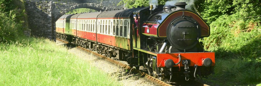
Originally opened in 1869 as a link between Barrow and Windermere, the line closed in the 1960s. Three miles of track re-opened in 1973 as a heritage steam railway.
Get the view
Start Haverthwaite Station
Grid Reference SD 34997 84240
What3words Reference factored.yummy.snowstorm
Park at Haverthwaite station, and explore the engine shed and tearoom. Then catch the train to Lakeside where you can join a lake cruise on Windermere to make a real day of it.
Best View Grid Reference SD 36667 86430
Best View What3words Reference explores.aims.panoramic
15 Windermere from Orrest Head
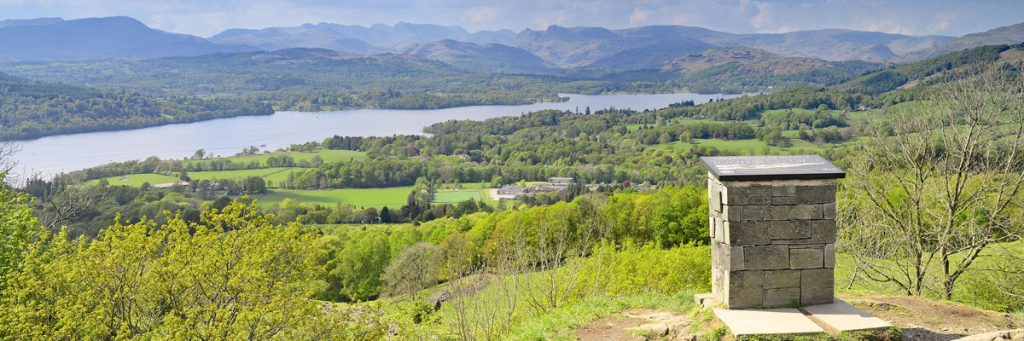
Orrest Head is of modest height (238m) but has endeared itself to generations of travellers who arrived and departed by train, as the short walk up to the top was often possible between connections.
Get the view
Start A591 Windermere Town near Bus and Train Station
Grid Reference SD 41292 98752
What3words Reference speedily.ordinary.trustees
A lane leads up-hill and into woodland for about ½ mile. A wheel-chair friendly path then leads up to summit for about ½ mile.
Best View Grid Reference SD 41428 99370
Best View What3words Reference novelists.boats.suitable
16 Lakeside, Windermere from Gummer’s How
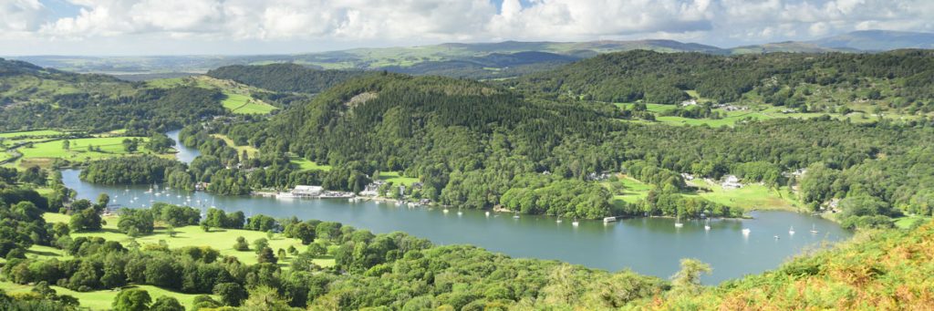
Although less than a third of the height of Lakeland’s highest mountains, Gummer’s How is the highest point for several miles around, giving it wide-ranging views over Windermere and the hills of the southern Lakes.
Get the view
Start Fell Foot Brow
Grid Reference SD 39027 87728
What3words Reference detect.nowadays.waltzes
A clear path leads direct to summit from gate on road. Total distance about ½ mile; the last ¼ mile is steep and rough in places.
Best View Grid Reference SD 38991 88447
Best View What3words Reference tolerable.fuzz.broom